of the largest Karakum and Kyzylkum deserts in the south.
Moreover, it is the Aral Sea basin, the zone of deserts and semi-deserts, and two great rivers - Syrdarya has played a decisive role in the history of this region (Amudarya as well). Together with their tributaries, they have provided life to the oases located along them in most of the territory, now known as Central Asia and Kazakhstan. Agriculture in the plains of these rivers since ancient times was based on irrigated agriculture, combined with cattle breeding, which from the very beginning of the Iron Age was represented by different types: sedentary, semi-nomadic, semi-settled and nomadic.
The territory of today's Kyzylorda region played a great economic and political role throughout the history of these rivers and the Aral Sea, which once bore the name of the Khorezm sea. In addition to the fact that the Syrdarya was the main link in the development of agriculture, it has always been the main transport artery on trade routes. Syrdarya was navigable and water was delivered to Yangikent by water. So it was not so long ago - until the middle of the last century, and the old people still remember these times. Along the river itself passed one of the most important caravan roads linking the southern and northern regions of the Eurasian continent.
Today ships do not sail along the river to the drying sea. The vast territories, once covered by innumerable gardens and fields, are further and further captured by the desert. It keeps deeper the traces of agricultural crops with highly developed irrigation systems and the numerous ruins of ancient cities. These cities have been known in Central Asia for a long time, a significant part of them are recorded on the oldest maps and in numerous descriptions of travelers. Today it is a place of sand, and here the desert reigns, drying up the remnants of the once powerful rivers and absorbing the Aral Sea under it, covering the glorious and tragic history of the heyday and destruction of civilizations of past centuries, vividly demonstrating how great a person is and small in the face of nature.
Back in 1558, an English traveller very accurately described the problems of the region, describing the city of Wazir, the capital of the West Khorezm specific principality of the 16th-17th centuries. He noted that the southern part of the fortress is located on a low, but very fertile land and that there are many beautiful fruits growing here. The water that this entire country enjoys is taken from the canals, which are conducted from the Amudarya-Daryalyk to the great depletion of this river. That's why it does not flow more into the Caspian Sea, as in the past. In the near future, this country will probably be ruined and become a desert because of a lack of water, when there is not enough water.
According to this legend, the prophet Suleiman was angry at one peer and sentenced her to exile to the most remote country in the world. He instructed him to take her to the place of exile to her deva. The devas flew for a long time, carrying pari on their backs, and could not find such a place until at last the deserted Khorezm arrived, which turned out to be suitable in all respects. But after fulfilling Suleiman's assignment, the dev decided to stay here himself, for during his long wanderings he fell in love with his beautiful captive. Khoresm residents, in their treatise, conducted their chronology from the beginning of the settlement of their country, "in 980 to Alexander" - one of the generals of Alexander the Great.

The time of the arrival in their country of the mythical hero Avesta and the ancient Central Asian-Iranian epic - Siyavush ibn-Kay-Kausa, who subordinated his authority to the "kingdom of the Turks", and the foundations of the son of Siyavush, Kay-Khosrov, the dynasty of Khorezmshahs, who ruled until the tenth century. Later, Biruni says, the Persian custom of chronological order was adopted by the Khorezmians to "count the years of the reign of every king from the Kay-Khosrov dynasty who ruled their country and wore the Shah's title."
It is well known that the Avestan tradition and Zoroastrianism as a religion were widely spread in the territory of Central Asia, according to the opinion prevailing in science, in the most ancient parts of the Avesta it is much connected directly with the Kazakhstan region. Thus, in one of the parts of this most ancient book on earth, the "faithful" Zoroastrian countries are listed. Among them, the Arianam-Vaja area is in the first place. According to the research of a number of scientists, the name of this country can be attributed to the delta region of the Syrdarya and although the mixture of real and mythical objects is quite common in the Avesta, and the monument itself was created over many centuries and in different parts of the Iranian world, and the same name is mythical the ancestral home of the ancient Aryans, nevertheless, in the Achaemenid epoch and later with this name there is a very definite concept related to the northern regions of the Central Asian - Kazakhstan region - the steppes, semi-deserts and deserts.
It is possible that the southern limits of this country in this sense reached the borders of the Amudarya. This also agrees with the data of "Little Avesta" about the homeland of Zarathushtra - in Arianam Vaija beyond the river Datiya on the river Daredge.
If we take into account the information of the Avesta that his teaching took some of the tours that lived on the island in the rift of the Ranha River, which some scholars identify with the Syrdarya, the homeland of Zarathustra is approaching Kazakhstan very closely and a number of other scientists, some hymns and cults of the Avesta are associated with Syrdarya and are created among nomadic tribes inhabiting the area.
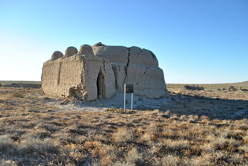
The remains of the cities, now known as Shirik-Rabat, Beshtam-kala, Babish-mullah, played an important role at that time - being on the main northern branch from the main trade route of the Silk Road. Avesta draws these cities as fortified settlements such as fortifications with residential walls. And their inhabitants as sedentary pastoralists and farmers, breeding large cattle, horses, camels. Heroes of the Avesta invariably come up with epithets: "rich in herds", "rich in bulls", "rich in horses", in their face a powerful martial aristocracy, whose martial exploits are full of lyrics, is clearly acting. But agricultural labor, built on artificial irrigation, was considered an honorable occupation here.
This is confirmed by the materials of archaeological research of the Khorezm expedition, which worked for many years in the delta of the Syrdarya. The most ancient monument of the Late Bronze Age is the burial ground of North Tagisken. Monumental mausoleums from adobe brick and skeleton-raw burial structures were excavated here. in the layout of the mausoleums, a circle and a square are combined, the orientations of the entrances to the east. The ruins of Shirik-Rabat are a huge oval ancient fortress dating back to the middle of the 1st millennium BC, surrounded by a system of concentric ramparts and ditches, within which a rectangular layout of the later antique fortress of the first centuries of our era is visible.
On the territory of the city there were also residential buildings and mausoleums and large mounds. The defensive walls were with a corridor and oval towers with loopholes in the plan. Another site of Babish-mulla had a rather complex plan: a rectangular fortress, inside which was a large house and two extensions. The walls of the main part of the city had small arrow-shaped loopholes, connected by three fans for servicing by one rifleman. This primitive fortification was combined with a powerful gate structure. In this two-story building, where the lower floor was occupied by rooms blocked by vaults, the passageways from which led to the central corridor with the gates to the fortress itself, there was a bridge from the ramp to the rooms of the second floor.
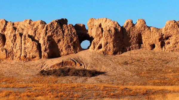
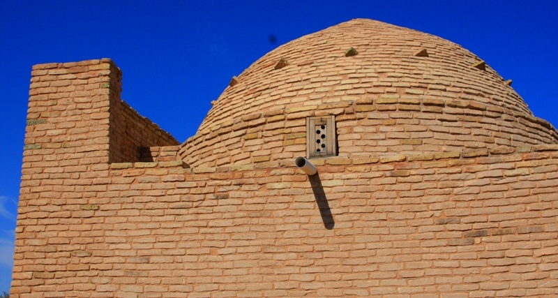
From the room adjoining the johnjon from the south and having in the outer wall of the battle-gallery of the knee-fighting, the passage led to the southern extension, occupied, apparently, by the private building. It was enclosed by a wall with oval towers with usual arrow-shaped loopholes. On a large house inside the fortress, in the lower layer, a part of the building, which repeats on its own plan, separate - the Achaemenid parade administrative buildings, was opened in the lower layer, which allowed to view the monument as a satrapy residence in the region of the "northernmost in the power of the region" Saks behind Sogdom. The mausoleum of Balanda is unique, it has been preserved to a sufficiently large height, which makes it possible to trace well the main types of structures and technologies used in the construction. Here, the lower part of the masonry of the dome, laid out with the technique of the false arch, is well preserved. In addition, during archaeological excavations, Tolstov discovered a pit from the pillar in the center of the hall, which suggests that these are traces of scaffold constructions for the construction of a true dome arch. However, these mausoleums still await more thorough architectural research and analysis.
Far from the boundaries of Khorezm, the general system of building structures and technologies, volume-planning solutions in the construction of defensive structures, are walls with internal rifle galleries and high arrow-shaped loopholes and towers, systems of labyrinths protecting the approaches to the gates. In this period the buildings of square raw brick dominate, different in form leaning vaults, covering both small and span, reaching five to six meters. For them, as a rule, a special trapezoidal brick was used. Probably, the widespread construction of the ceiling during this period was a false dome. Mass application of it was noted during excavations of pottery furnaces with a diameter of 4 - 5 meters and in ordinary funerary structures. Clink masonry was practiced with arches. All these constructions, as well as the raw construction of fortified settlements, were introduced into the region at the time when the Achaemenid satrapy was created in the lower reaches of the Syrdarya.
In the 11th century Syrdarya became Oguz river. So Mahmud Kashgari wrote, and to their cities he counted Sauran, Sygnak, Syutkent. But as archaeological research shows, Oguz tribes in the eleventh century lived not only in the Middle Syr Darya, but also in its lower reaches. There were the cities of Jent, Yangikent, which belonged to them. Yangikent was the capital of Oguz state. Today it is ruins, located not far from Kazaly, they are known under the name Zhankent. As scientists notes, the interest in Zharkent was shown and artists even made small excavations there.
.jpg)
Another city of Oguz Jent emerged in the form of an ancient settlement of Zhanqala, located 300 km from Kyzylorda. In the beginning of thirteenth century Jend was the capital of the Kypchak state. During the Mongol invasion, the city resisted the army of Zhoshy, was captured and plundered, but reborn after that again. Another famous capital of the Kypshak association is Syganak or modern Sunaq ata. As the historian Juvaini wrote in the thirteenth century, the city was completely defeated, and the population was carved by the Mongols in 1220 in retaliation for resisting the troops of Juchi. Despite this, the city is soon rebuilt and turns into a major political and economic center in the Syrdarya. In the dourteenth century. Sygnak becomes the capital of Ak Orda. Especially it flourished under Erzen and Urus khan. There were many mosques, khanaka and other public buildings. However, by the 16th century, according to Ruzbikhan, Sygnak had come into some decline, and the number of its inhabitants had declined, whereas in ancient times it "was blooming, surrounded by large structures and cultivated fields, rich in various products and a trading point.
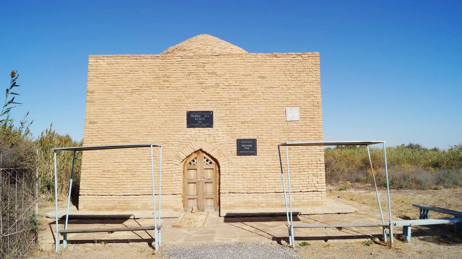
Merchants of the provinces of Turkestan, Maverannahr and from the East to the limits of Kashgar, Khotan bring to Sognak the goods of these countries and make trade deals and exchanges with Dasht people. "Many other architectural monuments of that period have survived to our days: The towers of the eleventh century. Saraman-Kosa, Begim ana, the mausoleums of the thirteenth century. two Sarlitama: on the Inkar Darya and on Zhanadarya, the mausoleums of the 16th century. Asan Ata, Oqshy Ata, Zhalanash Ata. Before us is a magnificent domed building, with a high portal decorated with turquoise majolica, not inferior to the mansions of Urgench. The dense place saved the mausoleum from parsing by practicing muslims Kazakhs, who are little considered with the old Muslim shrines, when they need a burnt brick for their ancestral cemeteries.
Traditions of construction of religious buildings continued in this region in the following centuries. They are especially pronounced in such a famous monument as the mosque of the nineteenth century Aktas. In its volumetric-planning solution typical regional features of architecture are manifested, expressed in forms, designs, details of decor. As already mentioned above, the main ways of traders, embassies, etc. passed through today's Kyzylorda region. On the old trade road, the Orenburg-Tashkent railway was built at the junction of the 19th and 20th centuries. Together with the road to the region, new construction of cities and settlements along its route has also come. At this time, even in the station settlements, the construction of buildings intended not only for the needs of the railway, but also for civilian purposes was carried out: hospitals, schools, mosques, churches. Russian military engineers took part in their construction and often used typical Russian projects that adapted to local conditions and traditions. Nevertheless, the historical development of the city of Kazalinsk, reflecting the main laws of urban development and architecture of that period, is perhaps the only one that managed to survive by the time it was taken under state protection.
The landscape of the Kyzylorda region is diverse and gives unforgettable impressions, the main of which is Sirdariya - unbridled, wild, giving life to all living in this region river. In the south there are severe spurs of the Karatau ridge. In small valleys, springs of crystal clear water of amazing taste are beating. A green carpet of herbs invites to rest after a long and difficult journey. The south-east of the region breathes the heat of Kyzylkum desert. Burning heat, singing barkhans, quicksand, monotonous desert ornament - are fascinating and remembered for life. In the north - the Aral Sea with turquoise water and a sandy beach. Reed thickets of the National Barasa - Kelmes nature reserve conceal from the outside eyes the nesting places of outlandish birds and a herd of rare species of steppe animals. From time to time the waves of the sea reveal the secrets of the history of the Middle Ages, presenting the ruins of ancient buildings. Here you can see fishing of flounder, small fishing vessels, try dishes from freshly caught fish.
A unique landmark of the landscape of the Kyzylorda region is the steppe - a global space, dotted with thousands of threads of ancient caravan paths, where the view dissolves in the horizon from east to west and from north to south. The population of the Kyzylorda region belongs to different ethnic groups. The overwhelming majority are Kazakhs, then Koreans, Russians, Tatars, Ukrainians, Jews, Chechens, Ingush, and Armenians. The urban population is more rural. The villagers are mainly engaged in breeding livestock, growing rice, fruits and vegetables. It is in the countryside that many folk customs, traditions and rituals are preserved.
Syrdarya is an ancient cradle of modern residents of the Kyzylorda region. Thus far they say respectfully that there are many ancient monuments, most of which were bright pearls on the threads of the Great Silk Road. The ruins of cities like Jend, Sauran, Yangikent are amazing today. Jend: In the 10th century, the city belonged to the Oguzes. Since the eleventh century and before the Mongol invasion, Jend was a significant city on the banks of the Syrdarya. Famous people of the Muslim world lived here. According to the medieval work of scientists, in the 12th century the Aral Sea was called differently.
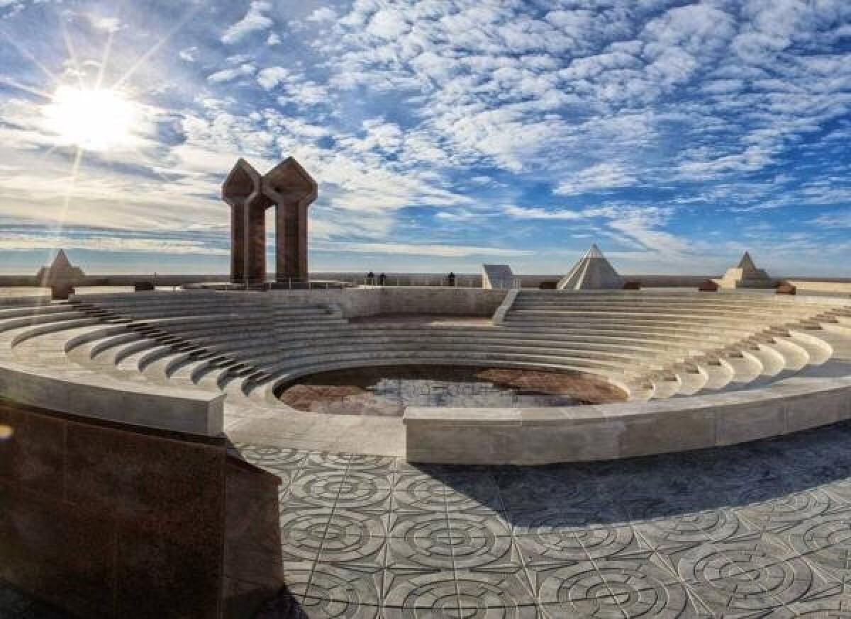
Notes about Yangikent were found in written sources of the tenth century. During the tenth and eleventh centuries, the city was the rate of Oguz rulers. Sauran, for instance, the first documents about Sauran are found in the historical works of the tenth century. At that time, Sauran was known as the most important strategic and trade center on the Syrdarya coast. In the middle of the thirteenth century, Sauran was the capital of the Ak Orda. At the beginning of the fourteenth century the city was captivated by the troops of Timur. The conducted scientific researches date Sauran in the 7th-18th centuries. Kyzylorda region is the homeland of the ancient thinker, musician and humanist Korkyt Ata, especially revered throughout the Turkic world. There are many necropolises with mausoleums - monuments to heroes, sages, poets, philosophers of the Kazakh people. All of them date back to the Middle Ages. The space of Kyzylorda region united the spiritual and material embodiment of the cosmos - Korkyt ata - a symbol of the search for eternal truths and the Baikonur cosmodrome - a symbol of the achievements of the technical thought of mankind, will certainly be of interest to the tourist.
In the lower reaches of the Syrdarya at various times were the capitals of our ancestors: Shirik-Rabat was the ancient capital of the Saks, while Zhankent was the center of the Oguz tribes. Especially in this row stands Syganak - the main city of the state of Ak Orda, which served as the basis of the Kazakh Khanate. The favorable position of the Syr Darya lower reaches region at the junction of a settled-agricultural world with a nomadic steppe, at the crossroads of the main trade routes made it the center of economic, cultural, economic contacts between the steppe and the city.
In the 12th century, Syganak became the capital of the Kypshak state association. In the second half of the fourteenth century the city became the capital of the Ak Orda. In Syganak, the khans of Erzen, his son Mubarek khoja, Urus Khan, Tokhtamysh ruled. There was a mint here, intensive construction was conducted. After the unsuccessful struggle of Tokhtamysh with Timur, the city was captured by the grandson of Timur Ulugbek, who tried to establish himself on the Syr Darya, but was defeated in 1423 and was thrown back to Central Asia by the troops of Barak, the grandson of Urus Khan. Back then, Syganak belonged to the Kazakh khans and was the largest city in the lower reaches of the Syrdarya. In its bazaars, daily goods were sold with 500 camel packs, in the vicinity they cultivated fields irrigated with Ordakent, Kyzyltal, Buzgul-Uzyak, Tomenryk and others. Among the numerous goods, bows and arrows were famous, brought by the steppe people, who bought grain, fabrics, and luxuries here. Merchants from Turkestan, Maverannahr from the East brought goods to Syganak, which were in abundance. But the development of the city was hampered by constant wars for owning it. Directly from the south to Syganak, the borders of the Timurid possessions were adjacent. The famous Ulugbek for some time captured the rich Syganak.
But in 1427 he was defeated by nomadic Uzbeks who came from the Aral sea, and the city passed into their possession. In 1428, after the death of the grandson of Urus-Khan Barak, power passed to Khan Abulkhair from the Sheibanid dynasty. In 1446 he conquered Syganak. Here he was buried. His mausoleum, which did not survive until our time, was known as Kok kesene, contemporaries described him as a very tall building. At that time in Syganak, the area of shahristan, surrounded by a partially preserved wall with 15 towers, was about 10 hectares. The area of the suburb, surrounded by an earthen rampart, is about 13 hectares. Water entered the city via a 20-kilometer canal from Tomenaryq from Syrdarya, as well as mountain rivers flowing from the slopes of Karatau. The whole subsequent history of Syganak is the history of wars for possessing it. Doctor of Historical Sciences Karl Baipakov notes that in the 80s of the 16th century Syunik was captured by Muhammad Shaybani, and then by the Kazakh Khan Burunduk. For a while, Syganak was a major economic center in the possessions of the Abdullah khan of Bukhara, after which he again went to the Kazakhs. Because of the constant wars, there was a decline.
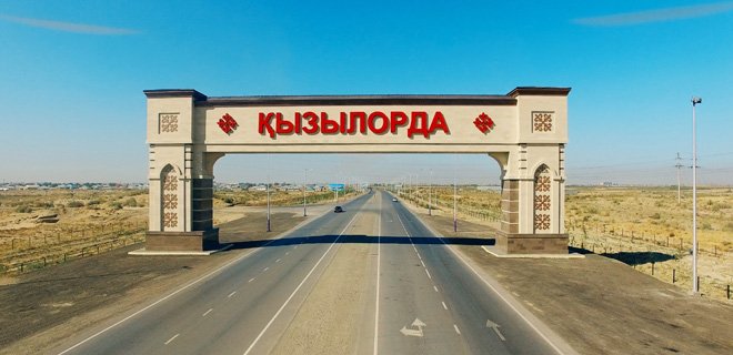
In the region, it is constantly taught about its history, traditions and crafts, art and nature. Here you can buy national souvenirs. The whole unique color of the eastern bazaar, with its noise, diversity and exotic goods, expressive oriental bargaining, can be assessed by visiting one of the two major markets in the city of Kyzylorda, or in any other large populated area of the region. Pedigree horses, experienced instructors and beautiful racing platforms are available for everyone at the city racetrack in Kyzylorda. Sarqyrama aryq is interesting from the sights of the cityscape. Currently it is significantly renovated, and continues to give townspeople a cool during the summer heat.
It so happened, according to the coincidence of ecological circumstances, that Kyzylorda region has turned into a huge museum on its territory-a repository of architectural monuments of a very wide range. From time immemorial, the most short-lived building materials from clay used in other climatic conditions here could not have survived several decades after people left the buildings. Here, in arid desert conditions, ruins and cities that played both in the Bronze Age and in the Middle Ages are very important on the trade routes between Europe and Asia. Good representativeness, authenticity, a large degree of concentration of monuments and their location near the cities represents a huge potential of the Kyzylorda region for its economic development.
.JPG)
